Geology
A karst landscape full of layers
The pale grey to greyish-blue limestone layers or tiers that dominate the Burren were laid down at the end of the Lower Carboniferous (Visean) period, some 340 million years ago and in some locations attaining a thickness of 780m. This limestone is composed of sediments and calcium-rich skeletal remains of marine organisms that populated the warm, shallow sea that lay over the region at that time. These were all eventually compressed by their own weight and that of the sea above, and subsequently elevated to reveal the massive, often fossil-rich, beds of rock that we see today.
Relatively insoluble shale bands separate these limestone beds, facilitating the formation of today’s terraced landscape. These bands originate from ancient periodic fluvial outwashes of mud from adjacent land masses onto the sea bed. Later, in the Upper Carboniferous (Namurian) period, the sea basin deepened and the fluvial outwashes of mud, sand and clay became the dominant depositional sediments. Eventually, following compression, these developed into thick (up to 330m) layers of shales, siltstones and sandstones as can be seen at the Cliffs of Moher today. These darker, impermeable rocks once cloaked the entire Burren but were largely removed through glaciation and now survive only intermittently in the west of the region around Lisdoonvarna and more consistently further south.
The Burren is quite stable geologically, as it is underlain by Tournaisian limestone and further underpinned by Galway granite. Ancient earth movements have however affected the region, contributing to the formation of the distinctive pattern of joints seen in the limestone (essentially vertical lines of weakness) that pervade the entire area, and when further weathered develop into the characteristic clint-gryke systems. These forces also resulted in the asymmetric north-east to south-west folding of the limestone layers in certain peripheral areas, such as the spectacular ‘syncline’ (dipping fold in the rock) seen at Mullaghmore Mountain.
Karst and Karen
 The relatively pure calcium carbonate limestone of the Burren is very susceptible to the solutional effect of the high rainfall levels in the region (rain is a mild carbonic acid) – it has been estimated that 0.005mm of limestone is dissolved annually. This effect is accentuated in places through the humic acids produced by heathy vegetation pockets. Solution of the limestone has resulted in the formation abundant karren and karst features in the Burren.
Karst, a term originating from a limestone region in (the former) Yugoslavia, is derived from the Slovenian word kras, meaning a bleak, waterless place. It is used to describe a landscape containing erosional features such as bare pavements, subterranean water systems, dry valleys, dolines and poljes. The Burren is recognised as one of Europe’s finest examples of a karst landscape, abounding in all of these features.
Some 100 closed depressions of various sizes occur in the Burren. Those of moderate dimension are called dolines, from the Serbo-Croat for valley or hollow, and a good example is found at Poulavallan near the Glen of Clab. Dolines are more or less circular, formed by solution, directly in some cases, or indirectly through the collapse of cavern roofs. Larger closed depressions known as poljes are more frequent in the Burren, and the best examples are found at Carran, Poulawillan, Caherconnell and Kilcorney.
Often providing a focus for agricultural settlement, these features were originally formed by ancient (Tertiary period) shale-based streams burning through the limestone beneath. The word polje derives from the Slav word for field, or an area that can be cultivated, and they are not unique to karst areas. Carran polje is c. 3.2 km long, 1.6 km wide, and over 60m deep.
Turlough is a term derived from the Irish words tuar and loch meaning ‘disappearing lake’. Turloughs are temporary (largely seasonal), shallow, groundwater-fed lakes surrounded by a rocky rim and lined with boulder clay, which are replenished and drained through discrete openings connected with the water table. They are strongly associated with zones of higher permeability in the aquifer in western Irish limestone lowlands. Some good examples in the Burren include sites at Carran, Aleenaun, and Turlough.
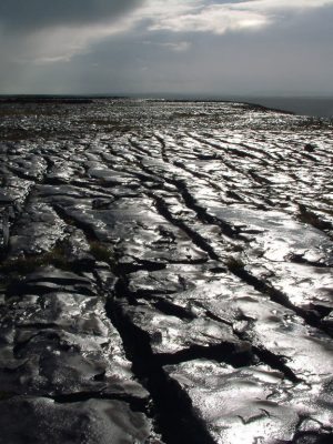
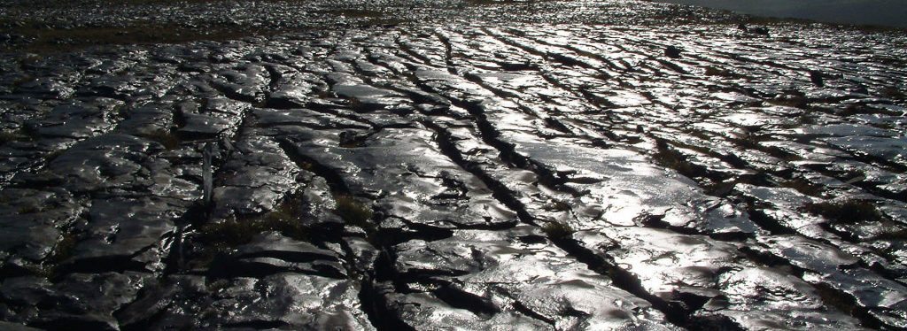
Probably the most characteristic karst feature of the Burren is the extensive pavement network, largely a product of glacial erosion and subsequent soil loss. There are two main pavement types, depending on the nature and structure of the limestone: smooth and shattered, with smooth pavements more common in the west Burren, shattered in the east.
These pavements are susceptible to solutional effects, which can eventually expose vertical lines of weakness in the limestone to form characteristic clint-grike systems. The clints or blocks range from a few square centimetres to over 65m2, with most ranging between 0.4 and 2.8 m2. The grikes, or crevices that dissect them, are usually less than two meters deep and 3.2 to 6.5 centimetres wide, but extend down to six meters in places.
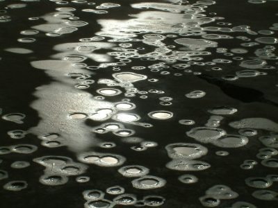
Karren (or ‘lapies’) is a general term used to describe the total complex of superficial micro-solutional features of limestone pavement, widespread in areas such as the Burren. Karren forms include sharp-ridged grooves (rillenkarren) and their larger, elongated cousins (rinnenkarren), as well as rounded runnells formed beneath a soil cover (rundkarren). Other forms include the ubiquitous solutional hollows (kamenitzas), deep cleft-like ruts or grikes (kluftkarren), clints (flachkarren), and horseshoe shaped stepped structures (trittkarren) found on the Burren coast.
Most karren features in the Burren are smooth rather than angular, suggesting that an extensive mineral soil cover must have existed in the area at one stage, a finding supported by pollen records from the area.
The caves of the Burren can be divided into two main groups: fossil and active. Fossil caves are those which no longer contain the streams of water which would have shaped them, and are thus no longer actively evolving. Many of the caves of the Burren uplands would be fossil: in recent years some of these caves have been the subject of archaeological excavation and have revealed a fascinating legacy of prehistoric use. Examples of fossil caves would include Kilcorney (the Cave of the Wild Horses) and Glencurran and Poulcarran, both of which are located close to Carron village.
Active caves in the Burren tend to be concentrated along the shale-limestone interface, particularly in the south-west Burren in the vicinity of Slieve Elva and Poulacapple. Here, rainwater streaming down from the acid surface of the shale hills burns swallow holes into the limestone, and these streams then work their way underground through the limestone, sculpting and shaping cave systems as they go. Some of these caves run for several miles, and it is thought that the vast majority of them remain unmapped. The dimensions of these caves are wildly variable, some very tall and narrow, others rounded.
Some sections are water filled (‘sumps’), others host spectacular stalagmites and stalactites (Poll an Ionain is said to contain the longest (7m) free standing stalactite in the world), while other caves are important visitor sites (Ailwee Caves).
The extensive network of caves that exists in the Burren represents a wonderful resource, one that, because of its often inaccessible nature, has not received the attention it deserves. However, from the casual visitor to the experienced potholer, these wonderful, mysterious cave systems have an enormous amount to offer.
Fantastic FACTS about geology in the Burren
- The pale grey to greyish-blue limestone layers or tiers that dominate the Burren were laid down some 340 million years ago and in some locations attain a depth of 780m.
- This limestone is composed of skeletal remains of marine organisms that populated the warm, shallow sea that lay over the region at that time. These all compressed over time to create the beds of rock that we see today.
- Darker, impermeable rocks once cloaked the entire Burren but were largely removed through glaciation and now survive only intermittently in the west of the region around Lisdoonvarna and more consistently further south.
- The relatively pure calcium carbonate limestone of the Burren is very susceptible to the solutional effect of the high rainfall levels in the region – causing karren features.
- Grikes are the gaps between the limestone pavement and clints are the chunks of pavements between the gaps.
- The Burren is recognised as one of Europe’s finest examples of a karst landscape.
- There are two main pavement types in the Burren, depending on the nature and structure of the limestone: smooth and shattered, with smooth pavements more common in the west, shattered in the east.

