Landscape
The term landscape can encompass a physical or cultural landscape. In this section we are dealing with the physical landscape. Understanding the physical landscape of the Burren is fundamentally important in order to appreciate the unique agricultural traditions that developed, and to achieve a greater understanding of the phenomenally rich natural and cultural heritage that have evolved as a result of these traditions.
The present day landscape of the Burren is a reflection of millennia of fluvial, glacial and solutional processes and, it would now appear, of anthropogenic (human) influence as well. The geological terminology most commonly used to describe the contemporary Burren landscape is ‘glaciated karst’, a reflection of the two most significant processes that sculpted it from its original, largely homogeneous, form.
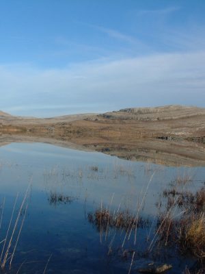
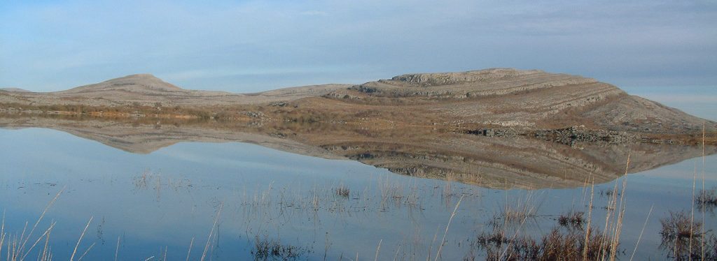
Over the course of the last Ice Age, which began roughly 1 million years ago, much of the overlying shales were stripped off the Burren, thereby exposing the limestone beneath to attack by erosive glacial waters, and subsequent scouring by the unremitting ice, removing any loose material. This tremendous erosive activity, acting along lines of weakness within and between the limestone layers, gradually etched out the distinctive terraces, pavements and other karst features visible in the Burren today.
The most recent glacial advance (the Midlandian, 35-13,000 years ago) in the Burren preceded from a north-east to a south-west direction, as attested by the orientation of the axes of glacial striations (scratches) and drumlins (deposits). The main effects of this glaciation was further erosion and scouring as well as the deposition of considerable amounts of calcareous drift, mainly spread along valleys, or alternatively in the form of drumlins, lateral moraines or fluvioglacial outwashes such as seen at Glencolumkille in the north-eastern Burren.
Relatively little sediment is thought to have been deposited in the Burren compared to elsewhere in Ireland, as the underlying limestone substrate and the proximity of the ocean provided escape routes for melt water. As a result, only a light covering of distinctive rounded boulders (glacial erratics) and sparse pockets of deposited sediment remained over large areas of the Burren, resulting in the very distinctive and unusual rocky landscape we see today.
Hydrology
It has been claimed, with some justification, that water, not rock, is the essence of the Burren.
Drainage in the Burren is largely subterranean, as over many millennia water courses in the region worked their way underground, reappearing periodically after heavy rainfall events. A consistent supply of surface water in the Burren is thus a rare and valuable resource, largely confined to the Caher River in Fanore and other ephemeral flows.
As a result, rural areas in the Burren traditionally had to rely almost exclusively on a combination of rainwater collection tanks and small springs for their water supply. The absence of a consistent supply of water in the Burren uplands, particularly in the summer season, is also an important factor in the evolution of the ‘winterage’ tradition whereby animals are put onto the upland grasslands over winter when water is more available.
Most of the central Burren (40% of the overall area) drains south into the Fergus, via the Elmvale springs north of Corofin. The northern Burren, consisting of the catchments of Ballyvaughan and Bell Harbour (12% and 14% of the Burren respectively) drains mainly through submarine outlets into the sea at Galway Bay. The western Burren, consisting of the catchments of Poulsallagh, Deereen, Caher and Fisherstreet (16% of the area) drains largely into the Atlantic Ocean.
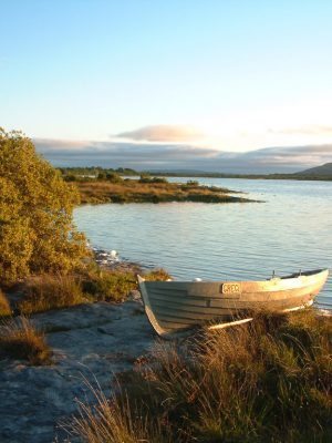
One fascinating reflection of the unusual hydrology of the Burren is the profusion of turloughs in the region. Turlough is a term derived from the Irish words tuar and loch meaning ‘disappearing lake’. Turloughs are temporary (largely seasonal), shallow, groundwater-fed lakes surrounded by a rocky rim and lined with boulder clay, which are replenished and drained through discrete openings connected with the water table. Europe’s largest turlough is found at Carron in the central Burren.
Karst areas such as the Burren are particularly sensitive to pollution because of the thin (or absent) soil cover that provides minimal attenuation of pollutants. Also, there is little attenuation by the rock itself due to the speed of water flow, which can reach over 100m/hr. A study by Drew, et al., (1995) concluded that ‘short of operating perfect management practices, such an environment does not possess the resilience to survive modern rural activities of the type described in this study’. As a result, particular care has to be taken in the control of pollutants, agricultural and domestic, generated in the Burren.
Fantastic FACTS about the landscape of the Burren
- The present day landscape of the Burren is a reflection of millennia of fluvial, glacial and solutional processes and anthropogenic activity.
- Over the course of the last Ice Age, which began roughly 1 million years ago, much of the overlying shales were stripped off the Burren – exposing the limestone beneath to attack by erosive glacial waters, and subsequent scouring by the unremitting ice, removing any loose material.
- This erosive activity, acting along lines of weakness within and between the limestone layers, gradually etched out the distinctive terraces, pavements and other karst features visible in the Burren today.
- Drainage in the Burren is largely subterranean, as over many millennia water courses in the region worked their way underground, reappearing periodically after heavy rainfall events.
- Due to underground water deposits, rural areas in the Burren traditionally had to rely almost exclusively on a combination or rainwater collection tanks and small springs for their water supply.
- Turlough is the only Irish word used internationally. These are temporary, seasonal, shallow, groundwater-fed lakes which are replenished and drained through discrete openings connected with the water table.
- The Burren plays host to Europe’s largest turlough,found at Carron in the central Burren.
- Karst areas such as the Burren are particularly sensitive to pollution because of the thin (or absent) soil cover that provides minimal attenuation of pollutants.
- Due to the rock’s sensitivity, particular care has to be taken in the control of pollutants, agricultural and domestic, generated in the Burren.

